The western boundary of this subsection consists of a series of end moraines that disrupted the spread of prairie fires from the west but did not provide sufficient protection for hardwood forests to become established. The subsection is bounded on the east by land dominated by hardwood forest. This boundary coincides with a increase in loess thickness. The northern boundary separates calcareous gray Des Moines lobe glacial till from red Superior lobe glacial till.
Much of this subsection is a rolling plain of loess-mantled ridges over sandstone and carbonate bedrock and till. At the southwestern edge of the subsection are moraine ridges. They are a continuation of those present in the Big Woods subsection, but smaller. As a result, fires from the surrounding prairies to the south, west, and east burned the landscape frequently enough to maintain oak opening rather than forest (Albert 1993). Presently, most of the subsection is farmed.
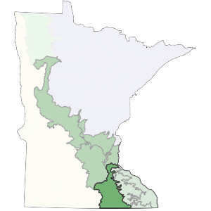
Landform
Much of the subsection is a loess plain over bedrock or till. Also included are Late Wisconsin end moraines, stagnation moraines, and outwash. Topography is gently rolling. The subsection contains few lakes. Stagnation moraines in the southwest are not large, but slopes are often steep.

Bedrock geology
Glacial drift is generally less than 100 feet thick within the subsection, with maximum thickness of about 200 feet (Olsen and Mossler 1982). Ordovician and Devonian dolomite (some limestone, sandstone, and shale) is locally exposed, especially in the dissected stream valleys at the eastern edge of the subsection (Morey 1976, Olsen and Mossler 1982).
Soils
The soils of the subsection are a mosaic of Mollisols and Alfisols. Alfisols correlate with savanna and forest vegetation, and Mollisols correlate with either upland prairie on relatively flat ridgetops or wetland prairies in broad depressions. Common soils include Aquolls (wet soils developed under prairie vegetation), Udolls (well-drained soils developed under prairie vegetation), Udalfs (well-drained soils formed under forest vegetation), and Aqualfs (wet soils developed under forest vegetation) (Cummins and Grigal 1981).
Climate
Annual normal precipitation ranges from 28 inches in the north to 31 inches in the south, and growing season precipitation ranges from 12.5 to 13 inches. The average growing season length ranges from 146 to 156 days.
Hydrology
Most of this subsection has a fairly well developed drainage network. This is due to the nature of landforms within the unit. There are few lakes; but they are present in the moraines that form the western edge of the subsection.
Historic vegetation
Bur oak savanna was the primary vegetation, but areas of tallgrass prairie and maple-basswood forest were common. Tallgrass prairie was concentrated on level to gently rolling portions of the landscape, in the center of the subsection. Bur oak savanna developed on rolling moraine ridges at the western edge of the subsection and in dissected ravines at the eastern edge. Maple-basswood forest was restricted to the portions of the landscape with the greatest fire protection, either in steep, dissected ravines or where stream orientation reduced fire frequency or severity (Albert 1993).
Present vegetation and land use
Presently, most of the area is farmed. Urban development is accelerating along the northern boundary.
Natural disturbance
Fire is the most important disturbance within the subsection. Tornados and high wind events also created significant disturbances. Periodic flooding occurs in river and stream valleys.
Conservation concerns
Species in Greatest Conservation need for the Oak Savanna Subsection