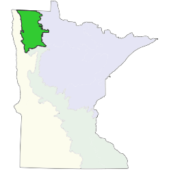
The Lake Agassiz, Aspen Parklands Section (LAP) is composed of a single landform, the basin of Glacial Lake Agassiz. About 60% of the section consists of sandy deposits from the shallow portions of Glacial Lake Agassiz. About 12% of these sandy deposits are beach ridges or complexes of shoreline deposits that mark successively lower levels of the glacial lake as it drained. Loamy till deposited by glacial ice and then inundated and flattened by wave action forms about 30% of the section. Clay and silt deposited in the deeper portions of the glacial lake cover about 10% of the section.There is no clear correlation between vegetation and parent material, as transitions between landforms are gradual. Historic patterns of vegetation appear mostly related to frequency and intensity of fire, which were influenced by variation in water table and soil moisture. The historic patchiness of fire created a complex mosaic of prairies, brushland, woodlands, and forests on uplands, and wet prairies, meadows, fens, and wet forests in wetlands. Upland prairie and wetland prairie communities were most extensive, covering 40% of the section. Wet meadow and marsh communities were common in seasonally wet depressions, occupying 14% and 7% of the section, respectively.Areas where the regional water table was at the land surface supported open rich peatland, forested rich peatland, and wet forest communities. These open and forested wetlands covered 10% of the section. Fire-dependent forest/woodland communities were present where seasonally wet depressions, peatlands, and river valleys isolated upland sites from fire, enabling survival of trees. These woodland communities covered 22% of the LAP and were variously described by early land surveyors in Minnesota as brush, brush with scattered timber, or timber, depending on length of time since the last fire on the site. Mesic hardwood forest and floodplain forest communities were present on sites exceedingly well protected from fire and were rare in the section.


Subsections are units within Sections that are defined using glacial deposition processes, surface bedrock formations, local climate, topographic relief, and the distribution of plants, especially trees. Minnesota has 26 subsections. Printable map of subsections