The Northern Minnesota Drift and Lake Plains Section (MDL) covers the center of northern Minnesota. The MDL has complex surface geology, formed over many episodes of glaciation. It is characterized by deep (200-600ft [60-180m]) glacial deposits in outwash plains, lake plains, till plains, outwash channels, moraines, and drumlin fields.The patterns of vegetation in the MDL reflect the complex and patchy distribution of these glacial deposits. Mesic forests of sugar maple, basswood, paper birch, aspen, and northern red oak are widespread. They occur mostly on moraines or till plains characterized by rough topography, fine-textured parent material, or soils with subhorizons that perch snowmelt and rainfall.Historically, forests and woodlands of jack pine and red pine were very common. These fire-dependent communities occur on the sandy outwash plains formed by glacial meltwater. Sandy and gravelly deposits that cap many of the major moraines in the western part of the MDL provide habitat for mixed forests of pine and boreal hardwood species such as quaking aspen and paper birch.The eastern part of the MDL is formed of deposits from glacial lakes Upham and Aitkin. These lake plains have expansive areas of acid peatland communities such as black spruce bogs and poor swamp forests, along with rich swamp forests of white cedar and black ash. Sedge meadows and alder and willow swamps occur along the sluggish streams draining the flat lake plains and along the Mississippi and Leech Lake rivers.

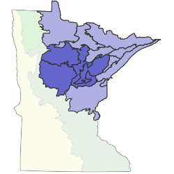
Subsections are units within Sections that are defined using glacial deposition processes, surface bedrock formations, local climate, topographic relief, and the distribution of plants, especially trees. Minnesota has 26 subsections. Printable map of subsections