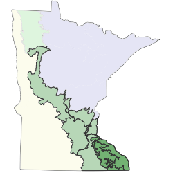
The Paleozoic Plateau Section (PPL) is a rugged region of bluffs and valleys that is quite different from the rest of the state. Although originally a plateau underlain by rather flat-lying sedimentary rocks of the Paleozoic Era, in the past 10,000 years the landscape has been highly eroded and dissected by streams and rivers tributary to the Mississippi River, such as the Root, Whitewater, Zumbro, and Cannon rivers and their predecessors.The remains of the plateau are most evident on interfluves along the western edge of the section; there is little evidence of the former plateau on the eastern edge of the section near the Mississippi River, where dissection is complete. Much of the section is blanketed with loess. The loess is thickest along the Mississippi River and thins to the west, where it becomes discontinuous, exposing eroded pre-Wisconsin till at the surface.
The most important factors influencing the pattern of vegetation in the historical landscape were slope, aspect, flooding, and the likelihood of burning; variation in substrate was important only locally, with most of the section covered by rather uniform deposits of loess or alluvium. Prairies occupied the flat, fire-prone remnants of the plateau in the western part of the section. Steep slopes in dissected areas were sufficiently protected from fire for woody vegetation to develop, although dry prairies were common at the tops of southwest-facing bluffs, with oak woodland developing downslope and northward and eastward along these slopes.Mesic forests were prevalent on north- and east-facing slopes, usually dominated by oak on the upper slopes, with basswood and then sugar maple increasing in importance downslope. Wet-mesic forests of basswood, sugar maple, black maple, elm, bur oak, black ash, and walnut were present on level, silty valley bottoms in dissected terrain. Sandy valley bottoms supported dry prairies, black oak woodlands, and, rarely, jack pine savannas and woodlands. The alluvial bottomlands of broad valleys such as that of the Mississippi River were covered with floodplain forests of silver maple and river birch and terrace forests of silver maple, elm, green ash, hackberry, cottonwood, basswood, and swamp white oak. River shore communities were present on sand bars and shorelines. Steep rock walls and rocky colluvium provided habitat for development of cliff and talus communities. Peatlands were nearly absent in the section, mostly limited to local areas where seeps and springs maintained sufficiently saturated conditions for accumulation of peat.